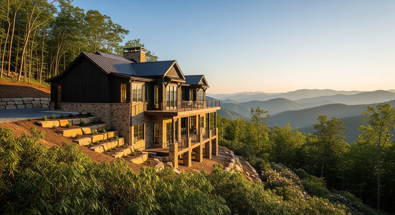
Chasing mountain views in Fairview? Before you fall for a hillside lot, you need to know how steep-slope rules shape what and where you can build. Buying in the mountains is exciting, but success comes from clear due diligence. In this guide, you’ll learn how Buncombe County’s rules fit into permitting, what triggers extra review, the permits and studies you may need, timelines and costs to expect, and a practical checklist you can use before you write an offer. Let’s dive in.
How steep-slope rules fit in
Buncombe County’s Unified Development Ordinance (UDO) sets local steep-slope and hillside standards. These rules guide where site disturbance, grading, and tree removal can occur on steep terrain. They work alongside other requirements like zoning, floodplain, and septic suitability.
Several departments may be part of your path to a permit:
- Planning & Development: zoning, site plan review, and steep-slope interpretation.
- Environmental Health: septic site evaluations and permits.
- Public Works or Engineering: driveway and road access, culverts, and rights-of-way.
- Building Inspections: building permits and inspections.
State involvement is common on hillside projects:
- North Carolina Department of Environmental Quality (NC DEQ): erosion and sediment control and construction stormwater permits when land disturbance meets thresholds.
- NCDOT: driveway encroachment permits when your access connects to a state road.
You will likely engage specialists:
- Geotechnical and civil engineers, land surveyors, septic designers, and local builders with mountain experience.
The big picture: steep-slope rules layer over everything else. A parcel that is buildable by zoning may still need special engineering, stricter grading limits, and protection of vegetation and drainage.
Slope thresholds, maps, and triggers
In the North Carolina mountains, many jurisdictions categorize slope bands and add stricter controls at steeper grades. Regionally, extra review often starts around the mid‑20 percent range and becomes stringent around 40 to 45 percent. However, exact numbers vary by county.
- Important: verify Buncombe County’s current numeric thresholds in the UDO or with Planning & Development. Do not rely on regional patterns alone.
How to verify a lot’s slope in Fairview
- Start with the Buncombe County GIS or Parcel Viewer to see official steep-slope layers and zoning for the parcel.
- Order a topographic survey or obtain LiDAR-derived contours for any serious candidate. A professional topo survey is the gold standard for design and permitting.
- Walk the site if possible. Note vegetation, rock outcrops, drainage paths, and elevation changes. Photos help contractors estimate access and grading.
When mapping triggers extra review
- If the likely building area falls within mapped steep or very steep zones, expect added submittals such as a site plan, erosion control plan, and possibly a geotechnical report.
- Even if you avoid steep areas for the home, a driveway or utility run crossing steep terrain can still trigger review and permits.
Permits and studies you may need
Typical permits and approvals
- County building permit: required for new dwellings and tied to approved site plans and grading limits.
- Site plan review or land disturbance approval: often required when steep slopes or significant grading are proposed.
- Grading and Erosion & Sediment Control plan: required when disturbance exceeds county or state thresholds. NC DEQ regulates construction stormwater in many cases. State erosion control commonly applies around 1 acre of disturbance, but confirm local application.
- Driveway/access permit: NCDOT issues permits for connections to state roads; the county handles county roads.
- Septic permit: Environmental Health evaluates soils and available drainfield area. Steep slopes, shallow soils, and bedrock can constrain septic design.
- Floodplain or wetland approvals: if applicable on your parcel.
- Stormwater management: may be required when new impervious area exceeds thresholds.
- Tree or vegetation removal rules: mitigation may be required in steep areas or drainage corridors.
- Variance or special exception: when strict compliance is not feasible, the Board of Adjustment may consider a variance.
Common technical studies
- Topographic survey: used to design the house, driveway, and grading.
- Geotechnical/soils report: evaluates slope stability and foundation recommendations.
- Stormwater and erosion control plans: prepared by a civil engineer.
- Septic site evaluation and design: confirms feasibility and system type.
Buyer due-diligence checklist
Immediate pre-offer checks
- Pull county parcel and GIS layers: slope, zoning, setbacks, floodplain, and any recorded easements.
- Confirm zoning and permitted uses, including minimum lot size and any overlay districts.
- Ask the seller for surveys, previous permits, septic records, and any geotechnical or site reports.
- Verify access: determine if the driveway intersects a state or county road and whether recorded easements exist if the route crosses neighboring property.
Contract contingencies that protect you
- Site feasibility contingency covering: topo and slope verification, septic prescreening, driveway and access feasibility (including NCDOT or county input if needed), geotechnical screening, and a county pre-application or zoning confirmation.
- Permit contingency timeline aligned with typical county review cycles that allows termination or renegotiation if conditions are unacceptable.
Who to call first
- Buncombe County Planning & Development for mapping, steep-slope policy, and pre-application guidance.
- Environmental Health for septic procedures and common reasons for denial.
- Public Works or Engineering for driveway, stormwater, and grading questions.
- NCDOT district office if your access meets a state road.
- A local land surveyor for topographic contours and slope confirmation.
- A geotechnical engineer for slope stability and foundation guidance.
- Local builders and septic designers experienced with mountain construction.
Risks, timelines, and costs
Red flags to investigate
- Most of the potential building area lies in mapped steep or very steep zones.
- No recorded legal access or a driveway that crosses another parcel without an easement.
- Evidence of past slide activity, large fill areas, or unpermitted grading.
- Shallow soils or near-surface bedrock affecting septic and foundations.
- Long driveways with extreme grades requiring switchbacks, retaining walls, and robust drainage.
- Private road use without clear maintenance agreements.
Typical timelines
- County pre-application check: days to weeks.
- Topographic survey: 1 to 3 weeks depending on complexity.
- Septic site evaluation: 1 to 4 weeks including fieldwork and queue times.
- Geotechnical report: 2 to 4 weeks after fieldwork.
- County site plan and grading review: 4 to 12 or more weeks depending on scope and completeness.
- Driveway and access permits: 2 to 8 weeks, longer for NCDOT cases.
- Building permit issuance after final plan approvals: typically several weeks.
Ballpark cost ranges
- Topographic survey: a few hundred to a few thousand dollars, based on lot size and detail.
- Septic evaluation and design: often 1,000 to 5,000 dollars or more depending on system type.
- Geotechnical report: commonly 1,000 to 5,000 dollars for residential sites.
- Driveway construction: from a few thousand dollars to tens of thousands for long, steep alignments with walls and culverts.
- Retaining walls, grading, and specialized foundations: can add tens of thousands of dollars.
- Plan preparation and permit applications: budget several thousand dollars for engineering and design.
Mitigation strategies that work
- Shift the home to a flatter bench or ridge to reduce grading and wall heights.
- Align the driveway to follow contours with gentle grades, even if it is longer.
- Choose foundation systems based on geotechnical guidance, such as deep piers or engineered footings.
- Implement strong erosion control and re-vegetation to meet county and state standards.
- Negotiate price adjustments or seller concessions to reflect added permitting risk and construction cost.
- Request a county pre-application meeting before you offer to gauge feasibility early.
Buying a hillside property in Fairview can deliver the privacy and views you want, but the key is to confirm feasibility up front. With the right team, a clear checklist, and early coordination with county and state reviewers, you can navigate steep-slope rules with confidence and avoid costly surprises.
If you are weighing a specific parcel or want a curated search for buildable view lots, reach out to Kim Gentry Justus at Christie's International Real Estate for a private, expert consultation.
FAQs
What counts as a steep slope in Buncombe County for Fairview lots?
- Slope bands and triggers vary by ordinance; verify current numeric thresholds with Buncombe County’s UDO or Planning & Development before relying on any general ranges.
How do I check if my Fairview driveway needs an NCDOT permit?
- If your access connects to a state road, an NCDOT driveway encroachment permit is typically required; confirm the road’s jurisdiction and contact NCDOT early.
Do I need a geotechnical report to build a view home in Fairview?
- It is frequently required or strongly recommended on steep sites to assess stability and foundation options and is often requested during county review.
How do steep-slope rules affect septic approval in Fairview?
- Steep terrain, shallow soils, and bedrock can limit drainfield locations; Environmental Health must confirm soil suitability and available area before issuing a septic permit.
How long does permitting usually take for a steep lot in Fairview?
- Expect several stages over weeks to months, with site plan and grading reviews commonly taking 4 to 12 or more weeks depending on scope and completeness.
What contract contingencies should I include on a Fairview hillside lot?
- Include a site feasibility and permit contingency covering topo, septic, driveway access, geotechnical review, and a county pre-application or zoning confirmation aligned with review timelines.