What if your after-work walk ended by a quiet river and your weekend hike started above the clouds? If you’re drawn to mountain views and a peaceful routine, Swannanoa delivers an easy blend of everyday trails, river access, and quick escapes to the Blue Ridge. In this guide, you’ll find where to walk, fish, wade, and hike, plus practical notes on commutes and safety. Let’s dive in.
Swannanoa at a glance
Set in a valley east of Asheville along I-40 and US-70, Swannanoa gives you small-town calm with fast access to city amenities. Typical off-peak drives to downtown Asheville often fall between 10 and 20 minutes, though a wider 10 to 30 minute range is common depending on start point and time of day. TravelMath’s drive-time estimate is about 14 minutes. For the best picture, test your route during your actual commute windows, especially in fall when visitor traffic can add time.
Everyday trails near home
Warren Wilson College trails
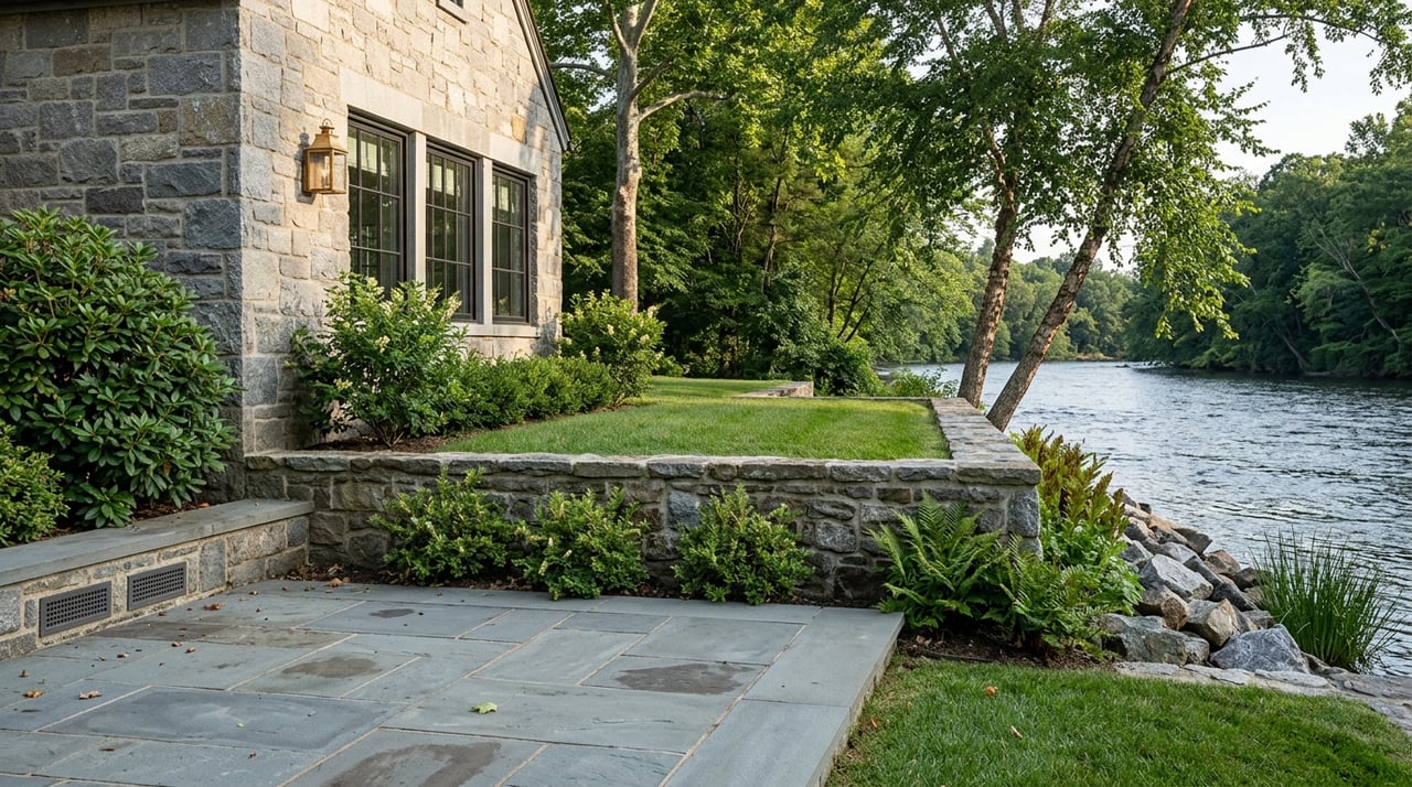
The Warren Wilson College network is a local favorite for easy to moderate walks, runs, and quick river access. Common routes include the River Trail, Dam Pasture, and the Jones Mountain and Bull Creek loops. Surfaces are mostly natural, shady, and peaceful for pre-work laps or sunset strolls. Parking at some access points is limited, and approaches can get muddy after storms. Verify current access before you go and consider arriving early on weekends. You can preview the riverside feel via the Warren Wilson River Trail overview.
Owen Park and Grovemont Park
For family-friendly greenspace, Owen Park offers ponds, open lawns, and space to stretch your legs near the water. Grovemont Park, beside the Swannanoa Library, is a neighborhood anchor known for community gatherings like Groovin’ on Grovemont. These parks make it easy to keep outdoor time in your daily rhythm without a full-day plan.
River access close by
Greenways for easy access
You’ll find approachable, family-ready riverfront along area greenways. Inside Asheville city limits, the Swannanoa River Greenway at Riverbend Park provides paved and natural paths, wildlife viewing, and casual walking. These stretches are ideal for quick dog walks, jogs, or a simple sit-and-listen by the water.
Swimming and wading spots
Locals often wade and cool off at shaded spots near the Warren Wilson River Trail, including a well-known swimming hole. Conditions vary with weather and recent storms, and parking is limited. Get a feel for the location via this Warren Wilson swimming hole snapshot, then verify access and water quality before you go. Pack out what you pack in and use caution with footing, current, and water levels.
Fishing the Swannanoa
Trout rules and licensing
Portions of the Swannanoa River are managed under North Carolina’s Public Mountain Trout Waters program, with hatchery-supported stocking on specified reaches. Anglers should confirm the exact rules for the stretch they plan to fish and purchase the appropriate inland license. Review the state trout water regulations and buy your recreational fishing license before heading out. After major storms, some access points can be temporarily closed or altered, so double-check conditions.
What you might catch
Reports from local anglers and apps note opportunities for stocked trout in managed reaches, along with smallmouth and largemouth bass, catfish, and, in colder upper sections, brook trout. Species and access vary by segment, season, and recent weather. Bring barbless hooks if you plan to release fish and always follow posted regulations.
Paddling basics
The Swannanoa is a tributary of the French Broad with changing depth and flow. In many places it is best for wading, quick splashes, or very short floats when levels allow. For longer paddling days, many people head to larger French Broad sections. Whatever your plan, build a current, conservative float plan and check local updates before you launch. River levels, debris, and access can change quickly after storms.
Parkway and Pisgah hikes
Blue Ridge Parkway highlights
From Swannanoa, you can reach classic overlooks and day hikes along the Blue Ridge Parkway in a short drive. Mount Pisgah is a well-loved example, offering a short but steep 1.5-mile round-trip to a panoramic summit. Preview the route and logistics via this Mount Pisgah hike guide. Parkway segments and trailheads can close for maintenance or storm recovery. Check the Blue Ridge Parkway morning report before you go, especially during shoulder seasons and after major weather.
Bent Creek and high country
If you want more miles, the Bent Creek area offers a dense trail network popular for mountain biking and longer trail runs. On cooler days, the Pisgah high country around Graveyard Fields, Black Balsam, and Shining Rock draws hikers for big views, rhododendron tunnels, and open balds. These destinations tend to be busier on weekends and during fall color, so plan an early start and expect parking to fill quickly.
Storm recovery and safety
Hurricane Helene and other recent storms left debris, downed trees, and erosion in many streamside and trail areas. Regional groups like MountainTrue and community partners are monitoring water quality and helping with cleanups and restoration. For a current status snapshot and ways to help, see MountainTrue’s Helene recovery update. On the ground, you may encounter closures, detours, or muddy approaches. Verify access on trail platforms and official pages, and when in doubt, choose a different route. The Parkway morning report is a helpful day-of resource.
Daily life and commute
Swannanoa feels quiet, but you’re close to essentials along Tunnel Road and Riceville, plus neighboring Black Mountain for dining and errands. Most residents drive for daily needs and commutes, with typical off-peak Asheville drives often in the 10 to 20 minute range and a broader 10 to 30 minute window depending on traffic. Try your route at your actual times to see how it performs during school-year mornings, leaf season, and holiday weekends.
Transit overview
Public transit in the corridor exists but is limited compared with in-town Asheville. There are bus options along the main corridor, and county-level services support specific needs. If transit is important to you, verify current ART routes and county schedules before you commit to a routine.
Quick relocation checklist
- Test your commute both directions at your usual times to see true drive times and seasonal effects.
- Check Parkway and Pisgah trail status the morning you head out using the Parkway morning report.
- Verify local trail and river access after storms on platforms like AllTrails’ Warren Wilson River Trail page and official pages.
- If you plan to fish, buy an NC inland license and confirm the exact trout-water rules for your reach via state regulations and license guidance.
- Follow local conservation groups like MountainTrue for updates on water quality, debris removal, and volunteer options during recovery. See their Helene recovery update.
Is Swannanoa a fit?
If you want everyday nature without giving up quick city access, Swannanoa hits a sweet spot. You can jog a shady riverside path before breakfast, let the kids run at a neighborhood park in the afternoon, then catch a sunset from a Blue Ridge overlook after dinner. Build your week around what matters most: time outside, quiet streets, and fast drives to Asheville’s dining and arts.
Ready to explore properties that put trails and river days at your doorstep? Connect with Kim Gentry Justus at Christie's International Real Estate for a curated consultation tailored to your outdoor lifestyle.
FAQs
Can you swim in the Swannanoa River near Warren Wilson?
- Yes, locals use shallow wading and swimming spots along the Warren Wilson River Trail, but conditions and access vary by season and post-storm status; check advisories and plan for limited parking.
How long is the commute from Swannanoa to Asheville?
- Off-peak drives often fall between 10 and 20 minutes, but a 10 to 30 minute range is common; test your specific route at your normal commute times.
Are Blue Ridge Parkway hikes crowded on weekends?
- Popular trailheads like Mount Pisgah, Craggy Pinnacle, and Graveyard Fields can fill early, especially during fall color; arrive early and verify road or trail closures before you go.
Is the Swannanoa good for trout fishing?
- Certain reaches are designated and stocked as Public Mountain Trout Waters; buy an inland license and follow NC trout rules for the exact segment you plan to fish.
Where can you walk a dog by the river in this area?
- The Swannanoa River Greenway at Riverbend Park and local stretches near the Warren Wilson River Trail offer approachable riverside walking; follow leash rules and pack out waste.